Based out of Bengaluru, Inferigence Quotient Pvt Ltd (InferQ) has developed products on remote sensing, surveillance, and hybrid navigation. The core strength of this company lies in signal and image processing, AI-ML, and advanced navigation systems for uncrewed platforms, enhancing their autonomy. This company led by Dr Neeta Trivedi, former Scientist ‘G’, DRDO, and a Senior Member of IEEE, has served Indian Defence Research and Development Organisation (DRDO), Indian Navy, as well as other national and international non-defence clients. Under the iDEX scheme of the Ministry of Defence, InferQ has won two challenges, and both are in the trial stages.
“At InferQ I have built a deep tech startup team, which is part of prestigious programmes aimed at AatmaNirbhar Bharat adding significant value to manned and unmanned aerial, surface, and underwater missions,” Dr Trivedi tells Financial express Online. Adding, “With the team’s skills and experience, jet-fuelled by the Government’s focus on building a national startup and MSME ecosystem, InferQ has won several prestigious grants from the Ministry of Defence and from the Government of Karnataka. InferQ is also a winner of herSTART, a funding scheme launched by the honourable president of India for women entrepreneurs. We are excited to be part of this history in the making.”
Dr Neeta Trivedi who also holds PhD from Indian Institute of Science, Bengaluru, in Multisource-Multitarget Information Fusion, has won several awards at organisational and national level. Ahead of the 2nd edition of the Swavlamban Seminar on October 4-5, 2023, she shares more details about the various products her company is working on.
Following are excerpts of an exclusive interaction:
What is iTAPS (Terrain-aided Positioning System)?
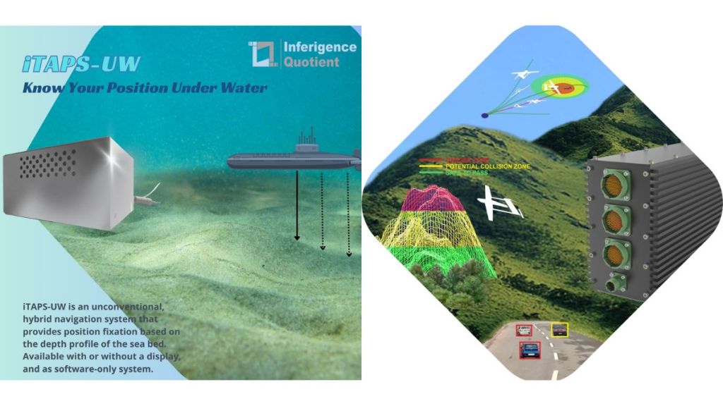
This system exploits the variability in the terrain elevation profile (or depth profile in the case of underwater applications) to improve the position estimate of a navigating platform. Agencies map terrain elevation and depth profiles at regular intervals for various purposes. When the profile is distinct enough in a local region, it can be used as a means for improving location estimates, which is particularly useful when satellite or other radio-based location information is unavailable, such as for underwater vehicles below periscope depths.
iTAPS employs statistical algorithms that are capable of incorporating prior knowledge, sensor biases and noises, and other system configurations.
Please share more about Chetas (Intelligent Surveillance and Collision Avoidance System).
Chetas is a compact, airborne, multiprocessor unit that can be repackaged/ reconfigured for multiple applications. In its present form, it performs terrain look ahead and collision avoidance, ground proximity warning generation in various phases of flight, non-cooperative collision avoidance with incoming aircrafts, and intelligent aerial surveillance. The system can generate collision alerts or, in the case of UAVs, can generate rerouting commands for the autopilot. The surveillance system is capable of detecting and tracking multiple ground objects in visible and thermal domains, geotagging them, and encoding in military standard formats. InferQ is working on variants of these products for other applications.
How did you get into developing these products and solutions? What was your inspiration?
I am passionate about state-of-the-art products Made in India for the World. Throughout my career spanning over 3 decades, I have had great opportunities to contribute to the Indian Defence and Aerospace Sector and I can proudly say that I have done complete justice to it. As a scientist in DRDO, I played a crucial role in hundreds of very successful initial flights for the prestigious indigenous Light Combat Aircraft programme ‘Tejas’, and then successfully led teams for R&D&E efforts towards state-of-the-art subsystems of the mission systems of aerial surveillance platforms.


