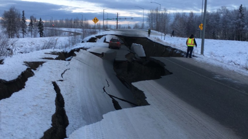
A magnitude 5.2 earthquake struck off the coast of Alaska‘s Aleutian Islands early Tuesday morning, according to the US Geological Survey (USGS).
The quake occurred at approximately 1 a.m. local time on September 16, with its epicenter located about 122 kilometers (75.8 miles) south-southwest of Nikolski, Alaska.
It had a shallow depth of 10 kilometers (6.2 miles). Authorities confirmed that no tsunami warning was issued following the event.
Tectonic activity in a volatile region
The Aleutian Islands lie along the Aleutian megathrust, a major subduction zone where the Pacific Plate is driven beneath the North American Plate.
This geological feature is responsible for some of the region’s strongest earthquakes. A similar quake struck the same area in June 2025, slightly closer to shore and at a greater depth, which triggered a temporary tsunami warning.
The current event, although similar in magnitude, did not meet the criteria for a tsunami alert due to its offshore location and depth.
Seismic unrest across the North Pacific
The North Pacific region is experiencing heightened seismic activity. On Monday, September 15, a series of earthquakes rattled Russia’s Far East, particularly near the Kamchatka Peninsula.
Four quakes were recorded within a short span of time. The first, a magnitude 5.2 quake, struck at 12:06 a.m. UTC about 63 miles east of Petropavlovsk-Kamchatsky at a depth of 21.8 miles.
Roughly an hour later, a magnitude 4.6 quake followed nearby, and shortly thereafter, a 5.1 magnitude event struck the same offshore region. Later that day, a stronger magnitude 6.0 earthquake hit the area at a depth of 15.2 miles.
These events follow a more powerful earthquake that occurred just two days earlier. On Saturday, September 13, a magnitude 7.4 earthquake struck off the coast of Kamchatka, with its epicenter located about 69 miles east of Petropavlovsk-Kamchatsky.
The quake occurred at a depth of 24 miles, shaking the region significantly and adding to concerns about regional seismic instability.
Earthquakes in Alaska this year
Alaska itself has seen considerable seismic activity in recent months. On July 16, 2025, a magnitude 7.3 earthquake struck near Sand Point on the Alaska Peninsula.
The quake, at a shallow depth of 20 kilometers, was widely felt across the southern coast, including in cities like Anchorage and Juneau.
A tsunami warning was briefly issued but was later cancelled as the threat diminished. This earthquake was linked to the Aleutian megathrust and is part of a pattern of large quakes in the region.
More recently, on August 28, a magnitude 5.9 earthquake was recorded near the Aleutian Islands, about 150 miles west of Adak. This event, which did not trigger a tsunami warning, was attributed to the deep tectonic activity common in this zone.
In addition to earthquake activity, Southeast Alaska experienced a dramatic geological event on August 10, 2025. A massive landslide occurred at Tracy Arm Fjord, triggering a mega-tsunami estimated to have reached heights of nearly 500 meters.
The landslide involved approximately 100 million cubic meters of rock cascading onto the South Sawyer Glacier, generating a wave that stripped forests and reshaped the local terrain.
The event was detected as a large seismic signal, consistent with a joint-controlled rock slope failure. Eyewitnesses reported a thunderous collapse, and detailed scientific reports have since been released by the Alaska Earthquake Center.
Seismologists continue to monitor the region closely, as both the North Pacific and Alaska’s tectonic zones remain highly active.
The Aleutian megathrust, in particular, continues to be a source of concern for experts, given its history of producing powerful and potentially tsunami-generating earthquakes.

