

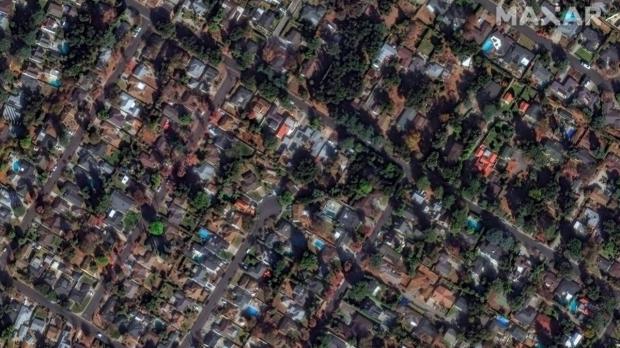
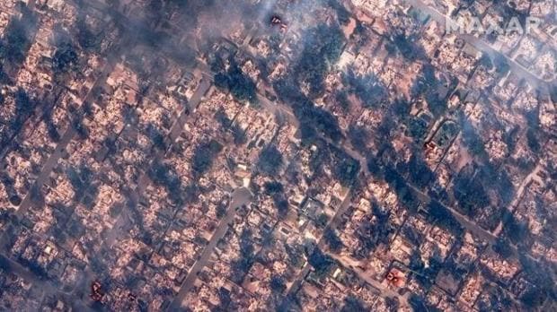
California is reeling from devastating wildfires that have claimed five lives, destroyed over 1,000 structures and forced the evacuation of more than 1,30,000 residents in the Los Angeles area.
Hurricane-force winds on Tuesday fanned embers across neighborhoods, igniting block after block and scorching 108 square km of land. By Wednesday night, six fires raged from the Pacific Coast to Pasadena, most of them uncontrolled.
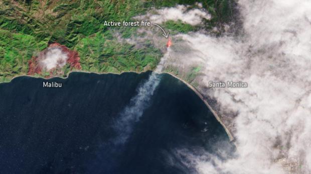
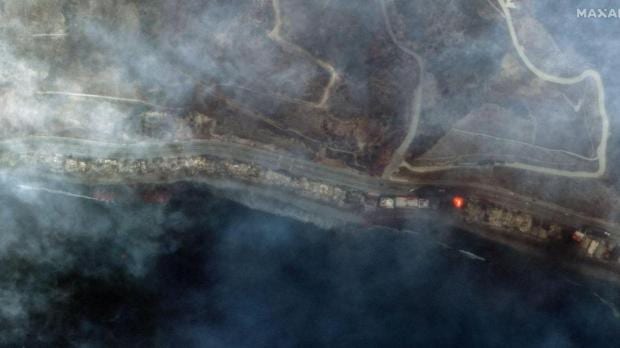
The Pacific Palisades fire alone devastated over 15,000 acres, leaving Malibu’s iconic coastline blackened and beachfront properties reduced to ashes. Satellite images captured the red glow of flames and thick black smoke blanketing East Altadena Drive.
These blazes, erupting outside the traditional wildfire season, signal the growing frequency of extreme weather events. Scientists warn that rising global temperatures are likely to exacerbate such disasters in the coming years.
The fires hit Southern California at a particularly vulnerable time, with the region still awaiting significant rainfall since the water year began in October.