



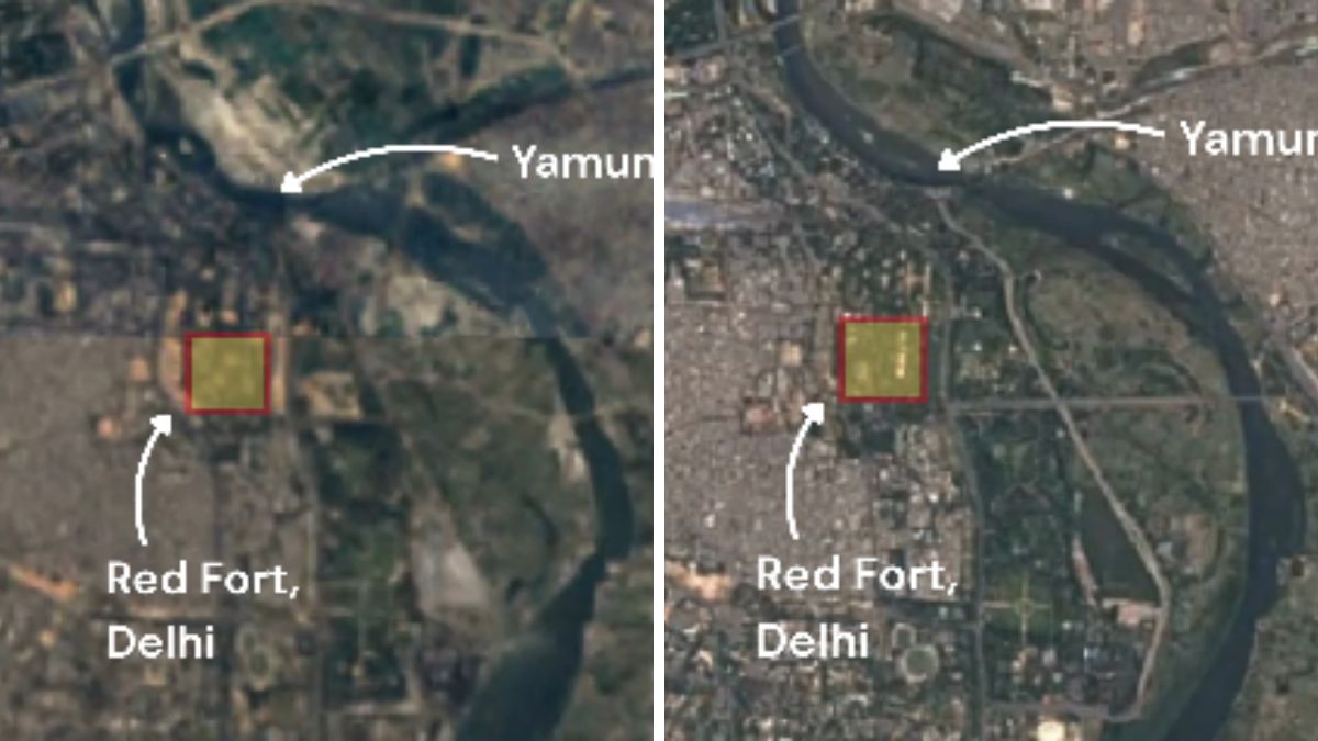
A study has reconstructed more than two centuries of changes in the Yamuna’s course through Delhi, revealing how urbanisation, river engineering and population growth have dramatically altered the river’s size and flow, news agency PTI reported.
Using a rare archival map from 1799 alongside historical records and modern satellite imagery, researchers found that the Yamuna flowing through Delhi has narrowed by nearly 68 per cent, while the volume of water flowing through the river has declined by around 89 per cent over the past 225 years.
The study was conducted by researchers from the Department of Geology, University of Delhi, and the Indian Institute of Science Education and Research (IISER), Bhopal. Their findings have been published in the paper, Two Centuries of Hydrogeomorphic Changes: Width-Discharge Dynamics of the Urbanised Yamuna River in Delhi.
Historic maps reveal how the river has changed
The researchers reconstructed the river’s historical course using an archival map prepared by Upjohn in 1799 and preserved at the National Archives of India, along with maps from 1893, 1924 and 1955, besides analysing Landsat satellite imagery and Sentinel-1 radar data.
“People have talked about changes in the Yamuna river in the Delhi stretch, but no one has talked about the changes in its discharge in the stretch on this timescale,” Professor Vimal Singh, one of the researchers told PTI.
According to the study, the 1799 map captures the Yamuna before the construction of barrages, providing a snapshot of the river in its natural state. The researchers estimated that the river’s average bankfull width has shrunk from around 658 metres in 1799 to nearly 210 metres in 2024.
Using the established relationship between river width and discharge, they estimated that the river’s flow has declined from approximately 30,000 cubic metres per second in 1799 to about 3,900 cubic metres per second in 2024.
Barrages, urbanisation and shrinking floodplains
The study attributes much of this transformation to human intervention rather than natural changes. It notes that Delhi’s population expanded from around 2.5 lakh in the early 19th century to nearly 2.15 crore in 2024, while multiple barrages, canals and embankments were built to regulate and divert the river.
The first major intervention came with the construction of the Tajewala Barrage in 1873, followed by the Okhla Barrage in 1874, the Wazirabad Barrage in 1959 and the ITO Barrage during 1966-67. According to the researchers, these structures substantially altered the Yamuna’s natural flow through Delhi.
The study also found that around 45 square kilometres of floodplains became disconnected from the river between 1912 and 2024 because of embankments built for flood protection. Many of these areas were later converted for agriculture and urban development.
Researchers also observed a sharp reduction in channel bars, with their area shrinking from about 20 square kilometres in 1985 to just four square kilometres by 2020, further altering the river’s natural morphology.
The study argues that these changes have reduced the Yamuna’s ability to absorb floodwaters. It cites the July 2023 floods as an example, noting that although upstream discharge during the floods was significantly lower than in 1978, the river recorded a higher water level in Delhi because its channel has become narrower and more constrained over time.
The researchers concluded that sustained human interventions over the past two centuries have transformed the Yamuna into a significantly narrower and lower-flow river, reducing its resilience to flooding and other extreme weather events.