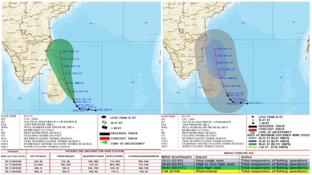
A deep depression over the southwest Bay of Bengal is expected to intensify into a cyclone by Wednesday and move towards Tamil Nadu, skirting the Sri Lankan coast over the next two days, the India Meteorological Department (IMD) said.
As of 8.30 am Tuesday, the depression was located about 310 km southeast of Trincomalee, 710 km south-southeast of Puducherry, and 800 km south-southeast of Chennai.
The IMD said it is likely to continue moving north-northwestward and intensify into a cyclonic storm on November 27, before continuing towards the Tamil Nadu coast and skirting the Sri Lankan coastline.
The IMD also issued a red alert for extremely heavy rainfall in three central Tamil Nadu districts on November 26 and two districts on November 27. A yellow alert for heavy rainfall will remain in effect for Chennai from November 27 to 29, with neighbouring districts such as Kancheepuram, Tiruvallur, and Chengalpet under yellow and orange alerts from November 27 to 30.
The depression is expected to bring heavy to very heavy rainfall to Chennai and Puducherry from November 25 to 27. Wind speeds could reach up to 65 km/h, gusting to 75 km/h, between November 25 and 26.
Earlier, on November 24, the IMD had reported that a well-marked low-pressure area over the southeast Bay of Bengal and adjoining East Equatorial Indian Ocean intensified into a depression.
By Monday night, it was moving northwestward at 18 km/h and was located 740 km south-southeast of Nagapattinam and 940 km south-southeast of Chennai. The depression is expected to continue intensifying and move towards the Tamil Nadu-Sri Lanka coasts in the coming days.

