Most people use Google Maps to find their way. But India now has its own navigation app called Mappls. It is made especially for Indian roads and traffic. The app focuses on everyday problems that Indian drivers face, instead of using a one-size-fits-all approach.
Finding Places Is Easier
Many places in India do not have clear addresses. This can make it hard for drivers, delivery agents, or visitors to reach the right spot. Mappls solves this by giving each location a short digital code. Users can share this code to help others reach the exact place without confusion.
Know Your Travel Cost Before You Go
Mappls helps users understand how much a trip may cost. It shows fuel and toll estimates before starting the journey. This is useful for people planning long trips or daily travel. Users can also choose routes that save money, not just time.
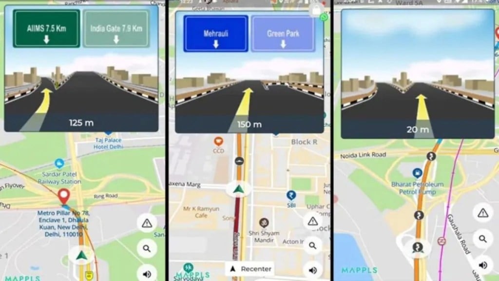
Better Help at Flyovers and Junctions
Flyovers and big junctions can be confusing, especially in cities. Mappls shows clear 3D views of roads and lanes so drivers know where to go in advance. This reduces sudden turns and helps drivers feel more confident.
Traffic Signal Timers on the Map
In some cities, Mappls shows live traffic signal timers. Drivers can see how long a red or green light will last. This helps reduce waiting time and makes driving smoother in busy areas.
Alerts That Match Indian Roads
Indian roads have speed breakers, sharp turns, and narrow lanes that many apps do not warn about. Mappls gives alerts for these road conditions, helping drivers slow down and stay safe.
Useful Local Option
While Google Maps is still popular, Mappls is becoming a useful choice for Indian users. Its local features and simple tools make it a practical navigation app for daily travel.