

By Raju Mansukhani
One hundred and ten years after World War I broke out in 1914, the deadliest of global conflicts which left more than 9 million dead across Europe, printed maps exhibited at the Maharaja Fatesingh Museum in Vadodara bring alive the theatres of war.
The exhibition, titled ‘Picturing Place: Painted and Printed Maps at the Udaipur Court’, is a collaborative effort of The Getty Paper Project, The City Palace Museum, Udaipur and the Maharaja Fatesingh Museum making possible the building of these bridges with the past, adding another dimension to our understanding of how our history was mapped, as it was shaped.
For those keen on military history, maps of the ‘Western campaign of World War I’ are displayed. The map, printed by W & AK Johnston, highlights the German Empire’s western front during 1914-1918, marked by a bold red line. Maps in the inset provide detailed views of Paris and Berlin, key cities in the campaign. These World War maps are preserved at the Maharana Mewar Research Institute (MMRI) at The City Palace, Udaipur, and have been made exhibition-worthy after years of painstaking conservation.

The World War I maps also convey the story of the massive contribution which the Indian Princely States made to the British war efforts. Said Dr Lakshyaraj Singh Mewar, trustee of Maharana of Mewar Charitable Foundation which manages the iconic City Palace Museum, “our illustrious great-great grandfather Maharana Fateh Singh extended generous financial aid including a loan of Rs 5 lakhs, troops and resources to the British.”
At the same time Rulers like Maharana Fateh Singh were not servile to the British, in fact as is often recounted, the Maharana of Mewar was the only invitee among the Indian Princes who, on a matter of principle, did not attend the Delhi Durbars of 1903 and 1911.
The exhibition-curator Dr Shailka Mishra explained, “We have a vast collection of over 500 maps, architectural drawings and blueprints preserved at the MMRI. There are series of painted maps. In pre-modern, or pre-colonial times, these painted maps were the visual means to tell stories.”
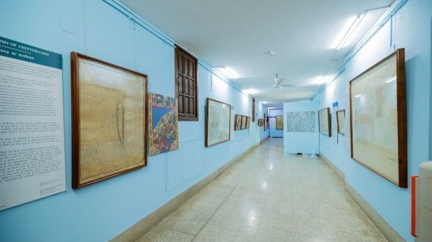
The pride of place is taken by the Chittorgarh maps; Chittor being acknowledged since the 8th-9th centuries CE as the ‘fort among all forts’. Presented are fascinating details of Chittorgarh: its history, genealogical charts of its rulers, and most significantly, the public spaces have been highlighted, the landscape and waterbodies marked, the till-date famous temples can be seen on the maps. No wonder these painted maps, some very large in size, remain historical documents providing an overview of the social and cultural life within the fort-city of Chittorgarh, once the capital-city of Mewar before the Maharanas established Udaipur and moved to the ‘city of lakes’ in the middle of the 16 century CE.
At the Vadodara Museum, there is another myth-shattering moment: it had been assumed that map-making and collection of topographic details began with the coming of the British, especially after the British imperial authorities began their subjugation and rule over India.
While the Court of Udaipur was famous for its writings on history and literature, exhibitions like ‘Picturing Place’ have put the spotlight on these maps, as part of a vibrant intellectual culture belonging not just to Rajasthan but the entire nation.
Through this exhibition, Dr Mishra highlighted the multifaceted purposes and interpretations of maps, from political and cultural motivations to imperialistic ambitions. “Seen together, it provides an opportunity to examine the visualization of architecture, landscape and topography in different mediums over two centuries,” said the curator.
‘Picturing Place: Painted and Printed Maps at the Udaipur Court’ was initially exhibited at The City Palace Museum in Udaipur, Dr Shailka Mishra said, “it has been curated in different themes. We have showcased some 53 objects including a diverse array of maps meticulously commissioned and collected by the Maharanas of Mewar. On display are seven paintings, 31 maps, one architectural drawing, 12 photographs, one photo album and one bahida from the MMRI.”
Digging into archives of MMRI, it was clear that historical documentation in the pre-modern era, whether in Mewar or in other Princely States, was second to none. The myth, propagated by the British colonial authorities, that Indian ‘natives’ had neither any sense of history nor the ability to maintain records, lies shattered.
Court records of Princely States provide details of daily events, visits, letters received and despatched, accounts and payments, assets and inventories; in today’s parlance these would be MIS reports, while Court records as in the State of Udaipur-Mewar are referred to as ‘Bahidas’. At MMRI, for instance, records of the last 400 years are available, awaiting digitization while several bahidas have been published.
The Udaipur-based MMCF received the grant from The Getty Foundation in 2021 to research, restore and plan exhibitions of these rare, never-seen-before array of maps and cartography-related documents, many of which were dating back to the 1700s.
At the exhibition inauguration on 22 June 2024, former Royal Families of Baroda and Mewar spoke highly of the efforts of the curatorial and research teams as they experienced the gallery displays. Rajmata Shubhanginiraje Gaekwad of Baroda, Maharaj Samarjitsinh Gaekwad of Baroda, and Maharaj Kumar Dr. Lakshyaraj Singh Mewar of Udaipur lauded the collaborative efforts which holds the promise of more exhibitions and workshops in future.
(Author is a writer-researcher on history and heritage issues, and former deputy curator of Pradhanmantri Sangrahalaya.)
(Disclaimer: Views expressed are personal and do not reflect the official position or policy of FinancialExpress.com Reproducing this content without permission is prohibited.)