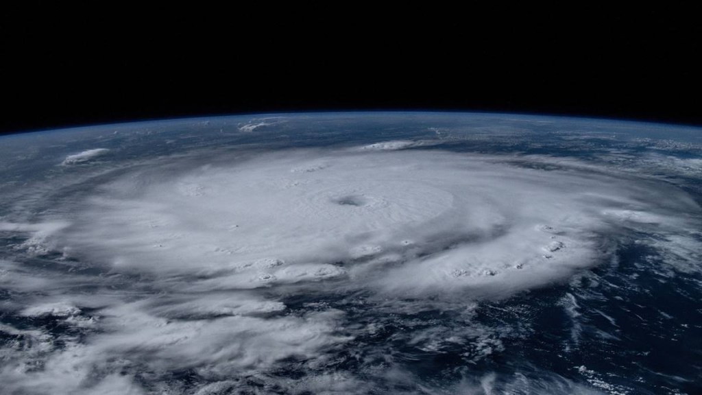
After bypassing Mexico’s prime beach destinations with its strong winds and heavy rain, Tropical Storm Beryl moved into the Gulf of Mexico on Friday afternoon. The storm, which had been downgraded from hurricane status, was projected to reach Texas by late Sunday. By Friday afternoon, Beryl’s center had traversed the Yucatan Peninsula, having made landfall near the coastal resort of Tulum earlier that morning. Wind speeds had diminished to approximately 65 miles per hour (105 kph).
Earlier this week, the storm, which at one time reached the strength of a powerful Category 5 hurricane, wreaked havoc across the Caribbean. But according to Laura Velazquez, the director of Mexico’s civil protection organisation, there were no fatalities in that nation during a press conference on Friday afternoon.
Beryl’s passage over Quintana Roo and Yucatan states in Mexico caused winds to slow down, but the U.S. National Hurricane Centre continued to predict severe storm surges in the vicinity.
For those who hunkered down as Beryl churned overhead, a sense of relief prevailed. “Holy cow! It was an experience! Really only some plants flew up in the air. Thank God we’re all OK,” said Mexican tourist Juan Ochoa, who was staying in Tulum.
Tourist infrastructure was without major damage in Quintana Roo, the state government said in a statement. Still, many in the area lost electricity, including 40% of Tulum, said Guillermo Nevarez, an official with Mexico’s national electricity company CFE, speaking to local broadcaster Milenio.
Civil protection chief Velazquez said she expected service to be restored in full by Sunday.
The Yucatan Peninsula, one of Mexico’s most popular vacation destinations, is renowned for its Mayan ruins, lush landscapes, and white sand beaches. On Friday, travellers who were stuck at Cancun’s international airport had no idea when they would be able to return home. Beryl, which is presently above the port of Progreso in the state of Yucatan in Mexico, was predicted to strengthen as it moved into the Gulf of Mexico, regaining hurricane status as it moved towards the western Gulf coast on Sunday.
A hurricane watch was in effect for the Texas coast from the mouth of the Rio Grande northward to Sargent, according to the U.S. National Hurricane Center (NHC). “There is an increasing risk of damaging hurricane-force winds and life-threatening storm surge in portions of northeastern Mexico and the lower and middle Texas Coast late Sunday and Monday where hurricane and storm surge watches have been issued,” the NHC said.
A hurricane watch was issued by Mexico’s meteorological agency for the country’s northeastern coast, extending from Barra el Mezquital to the mouth of the Rio Grande. It issued a warning that from Sunday through the middle of next week, flash and urban flooding was possible over parts of the Texas Gulf Coast and eastern Texas. Starting late on Sunday and continuing through the middle of the next week, areas of the Texas Gulf Coast and eastern Texas are expected to have 5 to 10 inches of rain, with isolated amounts of up to 15 inches.
Mexico’s major oil platforms, primarily located in the southern rim of the Gulf of Mexico, are not expected to be affected or shut down.
The ClimaMeter consortium’s research found that Beryl was considerably more intense due to climate change. The study found that the storm’s intensity, which is directly related to climate change, increased by 10–30 per cent, as did the rainfall and wind speed connected with it.
(with inputs from Reuters)

