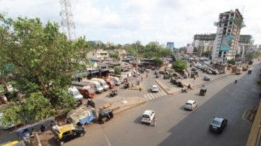
The Brihanmumbai Municipal Corporation (BMC), in collaboration with partners from the Bloomberg Philanthropies Initiative for Global Road Safety (BIGRS), have announced that they will transform Mumbai’s 20 highest crash-prone intersections, also known as ‘black spots’. The aim is to make Mumbai traffic junctions safer for all road users.
The partners have found that between 2019 to 2021, 132 people were killed and 429 were seriously injured at these 20 black spots in Mumbai. The Amar Mahal junction in Ghatkopar is the most dangerous intersection in the city, where in the three years span, 24 people were killed in road crashes and 46 were seriously injured.
As part of the understanding, the partners will work to make the junctions safer for all road users, especially pedestrians, cyclists, and motorcyclists, who are most vulnerable to road crashes. BMC will receive technical assistance from BIGRS partners including the Global Designing Cities Initiative (GDCI) and the World Resources Institute (WRI), India to redesign the 20 deadliest traffic intersections identified in the city.
Ulhas Mahale, Deputy Municipal Commissioner (Infrastructure) said, “These locations are a priority since they record a high number of deaths and injuries compared to other locations in the city. We will introduce design changes at these locations to reduce the number of crashes and save lives. BMC engineers are working along with the BIGRS partners to transform these junctions.”
WRI India and GDCI surveyed the black spots in 2021-22 and are now preparing designs to upgrade the infrastructure of these junctions and roads to make them safer for vulnerable road users – pedestrians, cyclists, and motorcyclists alike.
To reduce the number of crashes, fatalities, and serious injuries, and make the junctions safe to navigate, BMC, WRI, and GDCI will utilise varied infrastructure interventions like widening pedestrian crossings and sidewalks, the addition of new refuge areas to reduce crossing distances, and traffic calming measures including speed breakers, and rumble strips.
Dhawal Ashar, Program Head, Integrated Transport, WRI India, a partner under the BIGRS, said, “Providing adequate pedestrian infrastructure allows people to walk, stop and cross safely, thereby reducing the number of times they come in direct conflict with vehicles. This means designing for pedestrians will make the street 1. Safer for all road users, 2. Reduce conflicts between pedestrians and vehicles and 3. Also, smoothen and streamline traffic flow.”
Under the initiative WRI, India is working with the BMC on 12 junctions, including Amar Mahal.
Abhimanyu Prakash, Regional Lead, Asia and Africa, GDCI, a partner under BIGRS, said, “In collaboration with the Brihanmumbai Municipal Corporation (BMC), we at GDCI are rethinking the possibilities at these high-risk locations based on principles from the Global Street Design Guide, a set of design guidelines officially endorsed by and for the city of Mumbai. The toolkit of strategies being applied include widening pedestrian crossings and sidewalks, adding new refuge areas, and implementing traffic calming measures such as speed humps, and rumble strips. Additionally, lane alignment and narrowing will be applied at select locations to not only make the streets safer but also smoothen traffic flows. In line with our long-term goal of reducing road crashes in the city, we are complementing these interventions with training for BMC engineers and with the Mumbai traffic police department to equip staff with the knowledge of fundamentals of safe and sustainable street designs.”
The Ministry of Road Transport and Highways (MoRTH), defines a blackspot as a stretch of 500m on National Highway/State Highway/Urban Roads where for the past consecutive three years
a) In total 5 serious road crashes or crashes led to the death, or b) cumulatively 10 or more deaths.
| List of 20 high-risk intersections (2019 – 2021) | |||
| Rank | Name of Junctions | Deaths | Serious injuries |
| 1 | Amar Mahal Junction, Tilak Nagar, Ghatkopar | 24 | 46 |
| 2 | Intersection of EEH and JVLR, Kanjurmarg East | 13 | 47 |
| 3 | Intersection of WEH and Sion Bandra Link Road (Kalanagar Junction), Bandra East | 13 | 36 |
| 4 | Intersection of WEH and Jawaharlal Nehru Road, Santacruz East | 8 | 26 |
| 5 | Intersection Of Ghatkopar Andheri Link Road and Eastern Express Highway, Ghatkopar East | 9 | 23 |
| 6 | Priyadarshini Junction, Sion-Chembur | 7 | 23 |
| 7 | Intersection of WEH and JVLR, Jogeshwari East | 6 | 24 |
| 8 | Intersection of Eastern Freeway and Ghatkopar – Mankhurd Link Road, Govandi West | 6 | 20 |
| 9 | Sion Circle Junction, Sion West | 3 | 23 |
| 10 | Intersection of WEH and Akurli Road, Kandivali East | 6 | 19 |
| 11 | Intersection of WEH and Goregaon Mulund Link Road, Goregaon East | 6 | 19 |
| 12 | King Circle Junction, Matunga East | 2 | 18 |
| 13 | Intersection of WEH and N.S.Phadke Marg, Andheri East | 3 | 16 |
| 14 | Intersection of Santacruz Chembur Link Road and LBS Road, Kurla West | 8 | 11 |
| 15 | Intersection of Sion Panvel Highway and Ghatkopar – Mankhurd Link Road, Mankhurd | 5 | 14 |
| 16 | Chedda nagar junction, Ghatkopar East | 1 | 16 |
| 17 | Sanjay Gandhi National Park Junction, Borivali East | 2 | 15 |
| 18 | Sakinaka Junction, Andheri East | 4 | 13 |
| 19 | Intersection of WEH and SV Road, Dahisar East | 4 | 11 |
| 20 | Intersection Of Ghatkopar – Andheri Link Road and LBS Road | 2 | 9 |