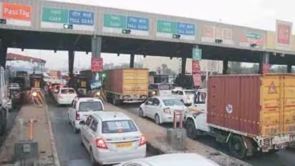
Highway toll has been a hot topic of discussion ever since the Fastags first came into existence in 2014. However, it took another five years before it could be implemented nationwide. But even after then, Fastags didn’t yield the result that the Government of India was expecting.
Hence, the Ministry of Road and Transport (MoRTH) earlier this year announced that it will introduce a more efficient method of collecting tolls on national highways and expressways. This gave birth to the GPS-based Global Navigation Satellite System (GNSS). The government has now released a new set of rules for the highway toll collection system.
Earlier in July this year, Union Minister Nitin Gadkari revealed that a pilot study with regard to a GNSS-based user fee collection system has been set up on the Bengaluru-Mysore section of NH-275 in Karnataka and Panipat-Hisar section of NH-709 in Haryana.
What is GNSS toll system?
GNSS will use the satellite-based global positioning system (GPS) to collect tolls from cars and heavy vehicles on highways and expressways. Not only collecting tolls, but this technology can be used to track vehicles assuring security. This system will allow vehicles to travel up to 20 kilometres on national highways, permanent bridges, bypasses, and tunnels without incurring any charges. This setup does not include vehicles with a National Permit.
Under the revised regulations, a “zero user fee” policy will be implemented for trips up to 20 km in either direction on toll roads, benefiting drivers, owners, and individuals in charge of vehicles. Beyond the initial 20 km, motorists will be charged on a per-km basis, ensuring a pay-as-you-go system that accurately reflects the distance travelled.
How will GNSS work?
Implementation of GNSS will not be a straightforward task and it may take a few years before it reaches some significant scale as the technology involves a series of complex devices. For starters, the vehicles will have to be equipped with an OBU (on-board unit) which acts as a tracking device for the toll collection system. The OBU will track the coordinates and send information about the vehicle route chart and distance travelled on the highways.
The OBU will be a non-transferable device which means it can’t be used for any other vehicle. The cameras installed on the highways will use Automatic Number Plate recognition (ANPR) and the existing FASTags for verification. The rules further mention that GNSS will require designated lanes for vehicles equipped with the OBU device for faster operation. Vehicles entering this dedicated lane without a functioning OBU device will be required to pay double the standard fee applicable at that particular toll plaza.
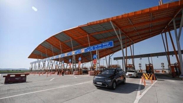
How’s GNSS different from FASTags?
The current FASTag system utilises physical booths for toll collection, but the new GNSS technology will introduce virtual toll booths along highways. These virtual booths leverage satellite technology to track the location and distance travelled by GNSS-enabled vehicles, eliminating the need for physical stops.
The OBU device installed in these vehicles will provide essential information, including vehicle registration, type, and the user’s bank account details, enabling seamless toll collection. Notably, the new GNSS setup is designed to operate in conjunction with the existing FASTag system, ensuring a smooth transition for users. This means that switching between GNSS and FASTag will be effortless, according to the announcement.
The government aims to revolutionise toll collection with its new GNSS-based system by reducing the current average waiting period from 714 seconds to a mere 47 seconds for each user. By streamlining the toll collection process, the government expects to minimise traffic congestion and ensure a smoother, more continuous flow of vehicles, enhancing overall driving efficiency and convenience.