

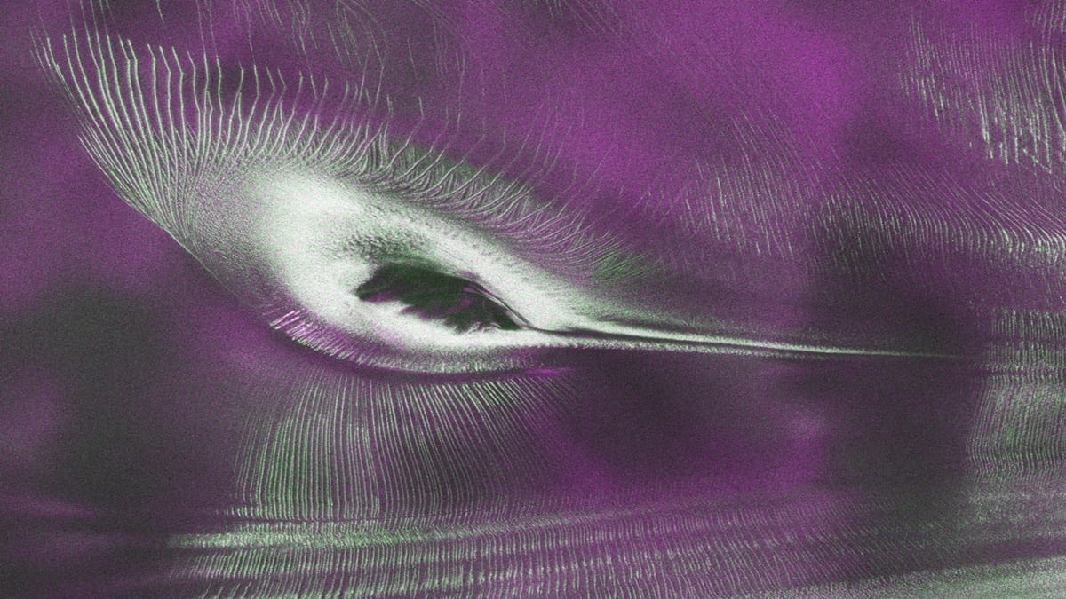
The NASA–ISRO Synthetic Aperture Radar (NISAR) satellite has captured an unusual image of an Antarctic landscape that appears to resemble a giant hummingbird. The striking formation, which has been nicknamed “the hummingbird,” is not an actual bird-shaped object but an optical illusion created by the combination of mountains, ice formations and radar imaging technology.
According to NASA, the image was among the early observations generated by NISAR’s L-band radar instrument, which revealed the fractured and barren Antarctic surface in remarkable detail.
“An early image revealed the fractured, barren surface of an Antarctic landscape in stark detail. In a merging of science and serendipity, it also resembles something else entirely: a hummingbird,” NASA said in a report.
How NISAR captured the image
The image was produced using radar signals transmitted towards Earth by NISAR. Unlike conventional optical imagery, the satellite uses microwave radar to study the Earth’s surface, allowing it to gather information even in challenging conditions.
NASA said the colours in the image represent differences in how polarised microwave signals interact with and reflect off snow, ice and rock.
The signals vibrate in different directions, and the nature of the returning signal provides scientists with clues about the surface from which it was reflected.
What the colours in the image mean
Over Antarctica, NISAR transmits radar waves towards the ground with horizontal polarisation. The returning signals can have horizontal, vertical or mixed polarisation, depending on the nature of the surface they encounter.

Magenta areas represent signals that return with horizontal polarisation. These signals are likely to have bounced off relatively regular surfaces, such as smoother stretches of ice.
Green areas indicate signals returning with vertical polarisation. NASA said these signals may have partially penetrated snow and ice or scattered at different angles after hitting irregular surfaces, including the faces of crevasses. This process is known as volume scattering.
White areas indicate strong returns from both types of scattering, suggesting a combination of surface and volume scattering.
A radar view of Antarctica
The same region, when viewed using conventional optical imagery, appears largely white because of the surrounding snow and ice. However, subtle shadows and ripples reveal the presence of the mountaintop, while the surrounding textures suggest that the ice surface is not completely smooth.
“The same scene viewed in optical light is almost entirely white with ice and snow. Slight shadows and rippling indicate the presence of the mountaintop, and textures in the surrounding area suggest the ice is not completely smooth,” NASA said.
NISAR’s scientific importance
The “hummingbird” image also highlights the capabilities of NISAR, a joint Earth-observation mission developed by NASA and the Indian Space Research Organisation (ISRO).
The satellite’s radar technology is designed to monitor changes on Earth’s surface, including ice movement, land deformation, vegetation and other environmental changes.