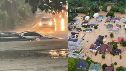
Meteorologists from the National Weather Service (NWS) issued an urgent alert late Wednesday morning as unusually heavy rain continued to soak desert regions across Arizona.
These areas normally receive only 1.5 to 2 inches of rain in an entire month, but many spots have already seen up to 3 inches in just the past 12 to 24 hours.
“They are getting over a month’s worth of precipitation out of this storm alone,” NWS meteorologist-in-charge Brian Klimowski told Newsweek.
The warning stressed that “flash flooding is ongoing or expected to begin shortly,” explaining how quickly conditions were becoming dangerous.
Flash flood warning issued
NWS Flagstaff issued the flash flood warning at 10:53 a.m. MST after radar showed thunderstorms loaded with heavy rainfall. Some areas had already received as much as 3 inches of rain, with up to another half inch possible.
The agency said the flooding was severe enough to be life-threatening. The warning included multiple desert counties, Coconino, Gila and Yavapai, where floods can form quickly due to dry soil and rocky terrain.
“Life-threatening flash flooding of creeks and streams, normally dry washes, urban areas, highways, streets and underpasses,” the warning said.
Several highways were affected, including State Route 260 near mile marker 248 and sections of State Route 87.
Swimming spots and natural areas were also under threat, including Fossil Creek, Fossil Creek Dam, the Verde River, Hardscrabble Creek, Houston Creek and West Clear Creek.
The NWS added, “Flooding of washes and creeks will occur, some dirt roads will become muddy and impassable. Paved roads and underpasses could become flooded as well.”
A wider flood watch remains in place for surrounding regions.
More storms expected
The heavy rainfall in Arizona is part of a larger weather system moving across the United States. Flash flood warnings, tornado watches, heavy rain, thunderstorms and snow are all in the forecast for different regions.
A large storm is expected to move out of the Southwest and into the southern Plains and lower Mississippi Valley on Thursday.
It will bring heavy rain and strong thunderstorms from Texas to Missouri. Some storms may produce high winds, hail and possibly a few tornadoes.
At the same time, another storm will move along the California coast, bringing rain and mountain snow to parts of Nevada. Southern California may see heavy rain from Thursday night into Friday, which could lead to new flash floods and mudslides.
Farther north, the Northwest will stay cloudy with scattered showers, while parts of the northern Plains remain mostly dry. Light rain may form around the Great Lakes. Most of the Northeast will have a chilly but dry day, though clouds could linger.
Strong Santa Ana winds are also likely in Southern California from Friday evening into early Saturday, with gusts possibly reaching 40 mph through canyons and passes.
