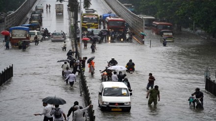
IMD forecasts heavy rain for Northeast as as depression over Bangladesh weakens
The India Meteorological Department (IMD) on Friday said the depression over Bangladesh is likely to weaken into a well-marked low-pressure area in the next 12 hours and will continue to bring heavy to extremely heavy rainfall to the Northeastern states till May 31. The alert comes amid an early onset of the southwest monsoon over Kerala, which arrived on May 24—its earliest since 2009.
Rainfall activity is expected to intensify across multiple regions, with the IMD forecasting widespread rainfall and thunderstorms over the northeast, parts of the south, and northwest India over the coming days.
Northeast braces for downpour
Northeastern states will continue to witness fairly widespread light to moderate rainfall for the next seven days, with isolated extremely heavy rainfall likely in Assam and Meghalaya on May 30 and June 1. Tripura and Arunachal Pradesh are also expected to receive very heavy rainfall on May 30. The IMD has issued a red alert for Meghalaya, where rainfall could exceed 30 cm in isolated areas.
Sub-Himalayan West Bengal and Sikkim are also expected to receive heavy rainfall from May 30 to June 1.
Western disturbance to impact Northwest India
The IMD also highlighted that a western disturbance is likely to cause rainfall, thunderstorms, and gusty winds across northwest India for the next 4–5 days. Scattered to fairly widespread light to moderate rainfall, accompanied by thunderstorms and winds reaching 40–50 kmph, is forecast over Jammu & Kashmir, Himachal Pradesh, Uttarakhand, Punjab, Haryana, Chandigarh, and Delhi. Isolated heavy rainfall is expected over Jammu & Kashmir and Himachal Pradesh on May 30-31 and Uttarakhand from May 30 to June 1.
Thunderstorm wind speed reaching 50-60 kmph gusting to 70 kmph likely over Punjab, Haryana, Chandigarh and Delhi, Uttar Pradesh on May 30, adding that dust storms are expected in parts of west Rajasthan between May 30 and June 5.
Southern states see active monsoon
With the monsoon’s early arrival over Kerala, southern states are also expected to receive widespread rainfall. Kerala, coastal Karnataka, and the ghat areas of Tamil Nadu are likely to experience heavy to extremely heavy rainfall on May 30, before intensity reduces. “Isolated extremely heavy rainfall is very likely over Kerala and Mahe on May 30,” the IMD said.
Fairly widespread to widespread rainfall is likely in Kerala, Karnataka, and adjoining regions until June 1. Isolated thunderstorms and gusty winds of 40-50 kmph are predicted across Tamil Nadu, Puducherry, Andhra Pradesh, Telangana, and Rayalaseema on May 30-31.
Western, Central India to receive rainfall
In western India, light to moderate rainfall with thunderstorms is likely over Konkan & Goa, Madhya Maharashtra, Gujarat, and Marathwada on May 30, with isolated heavy showers over Konkan & Goa continuing until June 2. Central and eastern parts of India, including Vidarbha, Chhattisgarh, Odisha, Jharkhand, Madhya Pradesh, and Bihar, are expected to receive rainfall between May 30 and June 1.
“Thunderstorms and wind speed reaching 50-60 kmph gusting to 70 kmph are likely over Madhya Pradesh, Chhattisgarh on May 30 and Vidarbha on June 2-3,” the department added.
Outlook for monsoon this year
The IMD reiterated that ‘above-normal’ rainfall is most likely over the country during the 2025 monsoon season (June-September). For June specifically, average rainfall is expected to exceed 108% of the Long Period Average (LPA). A forecast for July rainfall will be issued in the last week of June.
Above-normal monsoon is generally favourable for agriculture and water reservoirs, though it also raises concerns about flooding, infrastructure disruption, and public health challenges.
(With inputs from ANI)
