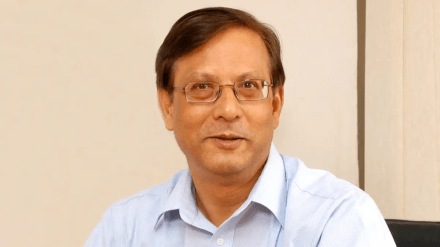
Railway Minister Ashwini Vaishnaw recently publicly endorsed MapmyIndia’s indigenous navigation app called Mappls, praising its advanced features and usability. He announced that Indian Railways will soon sign a memorandum of understanding (MoU) with MapmyIndia to integrate Mappls technology for various railway applications, aiming to enhance efficiency, real-time tracking, and passenger services across the vast railway network. Rakesh Verma, co-founder, chairman and MD of MapmyIndia Mappls, talks to Anees Hussain about the company’s deepening government collaborations, and expansion plans. Excerpts:
Q: Please tell us something more about your upcoming collaboration with Indian Railways?
Verma: This collaboration will enhance navigation at stations, improve real-time train tracking, strengthen logistics and operational efficiency, and ultimately improve passenger services. Railway Minister Ashwini Vaishnaw personally tested and praised the app, which validates our years of work in building indigenous mapping technology.
Q: How extensive is your current footprint in the public sector?
Verma: Around 20-25 states across the country are using our technology in some form or the other. On the Central side, departments such as GSTN, CBDT and the UMANG app under MeitY use MapmyIndia’s mapping APIs. Our tech also powered key national efforts, from COVID containment and vaccination tracking to G20 summit security operations with Delhi Police. We are aligned with ministries including Road Transport, Urban Development, Rural Development, Health and ISRO, and with initiatives under the Digital India framework. Together, these integrations show how deeply mapping is now embedded in the digital governance architecture.
Q: You recently launched real-time traffic signal wait-time tracking in Bengaluru. What are the expansion plans for this feature?
Verma: The signal tracker in Bengaluru has been very well received. We are in talks with three other cities, Pune, Jaipur and Hyderabad, where AI-integrated traffic systems are already in place. Once local police tie-ups are finalised, we will go live there as well.
Q: What is the current revenue mix between government and enterprise segments?
Verma: About 20% of our revenues come from government projects and 80% from private enterprises. We are selective about government work, focusing on centrally funded programmes to ensure accountability and timely payments. On the enterprise side, we power several major platforms. For instance, Apple Maps in India runs on our white-labelled technology. The Mappls consumer app remains free, helping us improve accuracy through real-time user feedback and giving visibility to our indigenous capabilities.
Q: How do you view the role of the consumer app in your overall strategy?
Verma: The consumer app sits at the centre of our ecosystem. It is our flagship product, a free, India-built navigation tool based on two decades of deep tech innovation. It also serves as proof of capability for our government and enterprise clients. We have crossed 35 million downloads, and following the minister’s endorsement, in the past few days downloads have surged to 200,000–300,000 per day. Once we reach around 100 million, we will explore advertising-led monetisation, but only after achieving the scale and trust that users expect from a service like this.
Q: You have talked about the need for a level playing field in mobile navigation. What is your view on Google’s dominance?
Verma: Google has used monopolistic tactics to arm-twist handset makers into pre-loading its apps. We have formally requested the government to ensure that while Google Maps remains available, Mappls should also come preloaded on smartphones. Consumers should have the freedom to choose what works best for them. We believe, this is aligned with India’s push for data sovereignty and digital independence. From the very beginning, all our data has stayed in India, our IP is fully owned by us, and we never resell user data. That is a clean, transparent model that strengthens India’s digital autonomy
Q: What are your international expansion plans?
Verma: We recently launched operations in ten Southeast Asian countries through a joint venture with Hyundai AutoEver Corp, called PT Terra Link Technologies, headquartered in Jakarta. This venture will develop in-vehicle navigation systems for markets such as Indonesia, Thailand, Vietnam, the Philippines, Malaysia and Singapore. Next on our radar is West Asia. While our platform is globally ready, mapping each region’s data and user nuances takes time. Our approach is measured and we expand only when we can deliver genuine local value.
Q: What is the long-term vision for MapmyIndia?
Verma: We have been building this technology indigenously for over 20 years, and we are now at a stage where we offer maps, mobility and data converge to power everything from smart cities to autonomous vehicles.
