


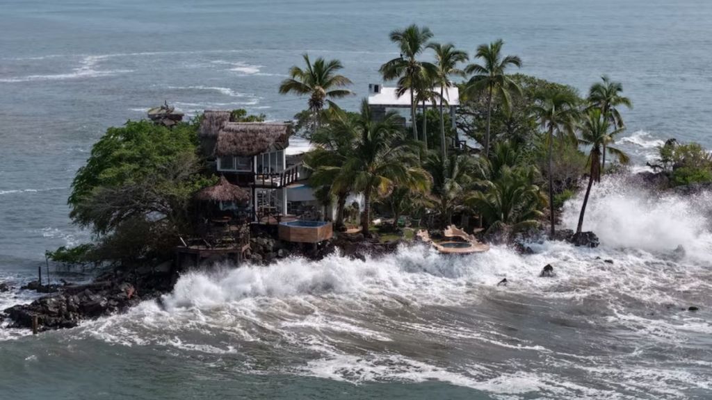

Hurricane Polo may never make landfall in the United States, but it still poses a significant flood threat to parts of the country. The storm is carrying tropical moisture north from Mexico into the Southwest and central US, with heavy rain possible across parts of Arizona, New Mexico, Colorado, Texas, Kansas and the central Plains.
The unusual part of the setup is that some of the areas facing flooding have also been dealing with drought or unusually dry conditions.
But dry conditions do not necessarily mean the ground can absorb several inches of rain quickly. Rocky or compacted soil, steep terrain, wildfire burn scars and paved urban areas can increase runoff and raise the risk of flash flooding.
The NOAA Weather Prediction Center has placed parts of the Southwest and southern Plains under a Moderate Risk of excessive rainfall. The National Weather Service has also issued flood watches in parts of the region.
The threat is therefore less about Polo’s hurricane-force winds and more about the moisture the storm leaves behind.
Why can drought-hit areas flood?
Drought and flooding can occur in the same region within days. When intense rain falls faster than the ground can absorb it, water runs across the surface and quickly enters streams, rivers and drainage systems. This can be particularly dangerous in mountainous areas, narrow valleys and locations affected by wildfires.
The National Weather Service office in El Paso forecast 1.5 to 2.5 inches of rain across the area, with isolated locations potentially receiving 3 to 4 inches. The agency warned that moisture from Polo and another tropical system, Odalys, could produce several days of heavy rainfall.
The WPC said the remnants of Polo would move north from Mexico near the El Paso region before tracking along the New Mexico-Texas border. The combination of tropical moisture and vulnerable ground conditions could increase the flash-flood risk.
Urban areas face a similar problem. Roads, parking lots and buildings prevent water from soaking into the ground, allowing heavy rain to become rapid runoff.
The result is that a region can remain affected by drought while simultaneously facing dangerous flooding.
How far could Polo’s moisture travel?
Polo began as a major hurricane over the eastern Pacific before moving toward Mexico. But as it weakens, its moisture can become part of a much larger weather system.
The WPC expects Polo’s remnants to interact with a broader weather pattern over the Southwest and Plains. That could allow tropical moisture to travel hundreds of miles inland and fuel thunderstorms and heavy rainfall well away from the storm’s original path.
The Washington Post reported that some areas could receive 4 to 8 inches of rain or more during the week. In parts of the Southwest, that would represent a substantial amount of rainfall compared with what the region typically receives.
Texas could also see several rounds of rain. The Houston Chronicle reported that parts of Central Texas could receive 4 to 6 inches, while the Houston area could see 2 to 4 inches through the weekend.
The exact totals will depend on the storm’s track and where the heaviest rain develops. That is also why Polo’s impact cannot be judged simply by whether it remains a hurricane. The storm can lose its hurricane status while its moisture continues to produce dangerous rainfall.
Which areas are at risk?
The initial flood threat is concentrated across the Southwest and Four Corners region, including parts of Arizona, New Mexico, Colorado and the Texas Panhandle.
The risk could then spread into wider parts of Texas and the central Plains as the moisture moves east.
The WPC has warned of a broader multi-day excessive-rainfall and flooding threat across parts of the south-central and east-central US later in the week.
However, that does not mean every location in those states will experience flooding. Local rainfall intensity, terrain, drainage and the movement of individual thunderstorms will determine where the most serious impacts occur.
The combination of Polo’s moisture with other weather systems is what makes the setup particularly important. Repeated rounds of rain could leave less time for water to drain between storms, increasing the risk of rising rivers, flooded roads and flash flooding.
The arrival of heavy rain may provide some short-term relief from dry conditions, but it does not automatically end a drought.
Drought recovery depends on water reaching soil, reservoirs and groundwater over a longer period. Extremely heavy rain can instead run off quickly, causing flooding while providing less long-term water benefit than slower, more sustained rainfall.
Polo’s US impact therefore extends well beyond the storm itself. Its strongest winds may remain far from the country, but its moisture can become fuel for a much larger rainfall event.
For residents and emergency officials, the key risks over the coming days will be heavy rainfall, flash flooding, rising rivers and dangerous road conditions.