


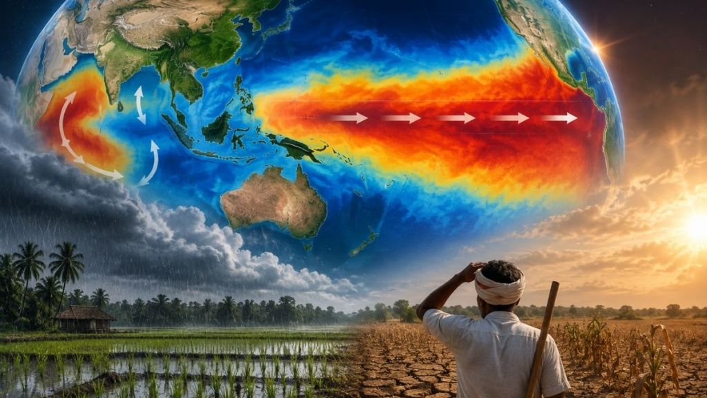

A very strong El Nino is taking shape in the Pacific Ocean and could become one of the strongest on record. The World Meteorological Organization (WMO) said on September 3 that El Nino had become firmly established and was likely to strengthen further in the coming months.
WMO forecasts give the event a nearly 100% chance of continuing through February 2027. Exceptionally warm waters in the tropical Pacific could drive major changes in rainfall and temperature patterns around the world.
But another ocean signal could complicate El Nino’s impact on India. A positive Indian Ocean Dipole (IOD) is also expected to develop during September-November, with WMO forecasting a seasonal average IOD value of about 0.9°C.
The combination matters because El Nino and the IOD can interact and alter the usual weather pattern. But that does not mean the Indian Ocean will cancel out El Nino’s effects.
WMO says the combination of El Nino and a positive IOD can “reinforce, weaken or alter typical El Nino impacts in different regions”.
For India, the distinction is important. The country has already experienced a weaker-than-normal monsoon in 2026, with September rainfall running below normal and concerns emerging over crops including cotton, soybean, maize and rice, Reuters reported.
How strong is this El Nino?
El Nino develops when sea-surface temperatures become unusually warm across parts of the central and eastern tropical Pacific. That warming changes atmospheric circulation and can shift rainfall and temperature patterns far beyond the Pacific.
WMO’s July 31 assessment said El Nino was strengthening steadily and forecast the seasonal average sea-surface temperature anomaly to exceed 2.9°C in key monitoring regions during August-October.
Its September 3 outlook puts the expected Nino 3.4 sea-surface temperature anomaly at about 3.6°C for September-November, with the event expected to peak around November-December.
The current event has already ranked among the four strongest El Nino events since 1950, Reuters reported. WMO describes it as “very strong” and expects it to intensify further, although it has not officially labelled it a “super El Nino”.
India’s Ministry of Earth Sciences said on July 30 that there is no officially defined category called “Super El Nino” under either WMO or the India Meteorological Department (IMD). El Nino events are generally classified as weak, moderate, strong or very strong based on sea-surface temperature anomalies in the central equatorial Pacific.
The ministry said IMD had predicted El Nino conditions during the 2026 southwest monsoon. Conditions were weak in June and strengthened to moderate levels in July, with El Nino expected to strengthen further during October-December and potentially reach the very strong category.
The timing is significant because El Nino typically reaches its strongest phase towards the end of the year, after India’s main southwest monsoon season.
That does not eliminate the risk to India. El Nino can influence rainfall and temperatures beyond the monsoon period, although the effects vary from one event to another.
WMO said a strong El Nino can shift rainfall patterns and increase the risks of floods, drought and extreme heat. Its September outlook also forecasts above-normal temperatures across almost all land areas.
Can a positive IOD soften El Nino’s impact?
The Indian Ocean Dipole is a separate climate pattern that measures the difference in sea-surface temperatures between the western and eastern tropical Indian Ocean.
A positive IOD generally means warmer-than-normal waters in the western Indian Ocean and cooler-than-normal waters in the east. WMO’s July 31 update said a positive IOD was expected to develop alongside the strengthening El Nino. Its September 3 forecast puts the September-November seasonal average IOD value at 0.9°C.
The IOD matters because it is one of the climate drivers that can influence weather around the Indian Ocean basin. India’s weather authorities track both signals when assessing the monsoon.
A government release on April 30 said neutral IOD conditions were present at the time, but climate models indicated that a positive IOD could develop towards the end of the southwest monsoon. It also said sea-surface conditions in the Pacific and Indian oceans have a strong influence on the Indian monsoon.
But the available forecasts do not support saying that a positive IOD will definitely blunt or cancel the effects of El Nino over India. WMO uses more cautious language. It says the two oceanic patterns can “reinforce, weaken or alter” typical El Nino impacts in different regions.
That means the positive IOD could modify the effects of El Nino, but the exact outcome for India will depend on how both systems evolve. The IMD has also said that the intensity and effects of El Nino over India depend on wider coupled ocean-atmosphere conditions, with El Nino being only one factor.
The latest rainfall data show why that caution matters. India’s rainfall in September was 35% below normal at that point, Reuters reported. June rainfall had also been 35% below normal, while August remained deficient.
The shortfall has raised concerns for summer crops at important stages of growth. Reuters reported that a continued deficit could make 2026 India’s weakest monsoon in nearly two decades.
September rainfall is important not only for standing crops but also for soil moisture and preparations for winter crops such as wheat, rapeseed and chickpeas.
What does it mean for India?
The developing El Nino adds another layer of uncertainty to India’s weather outlook. But the positive IOD means the Pacific signal cannot be viewed in isolation. WMO’s latest assessment specifically includes the IOD in its outlook and says the two oceanic patterns can interact differently across regions.
That is the strongest factual basis for asking whether the Indian Ocean can soften El Nino’s impact. It can alter the way El Nino affects different regions, but there is no official forecast saying it will fully offset the Pacific event’s effect on India.
The coming months will therefore depend on how the Pacific warming and positive IOD evolve together. WMO expects El Nino to persist through February 2027, while the positive IOD is expected during September-November.
WMO said a very strong El Nino can cause significant changes in rainfall and temperature patterns and increase the risks of extreme heat, drought and floods.
The positive IOD could modify that pattern. But it cannot yet be treated as a shield against a potentially record-strength El Nino.
Therefore, the Indian Ocean may change how El Nino affects India, but it cannot yet be counted on to protect the country from its effects. That uncertainty makes the coming months important for agriculture, water management and weather preparedness.